The Mud Flood Survey — Archive Plate 47B, City of New Eldwick
$21.00
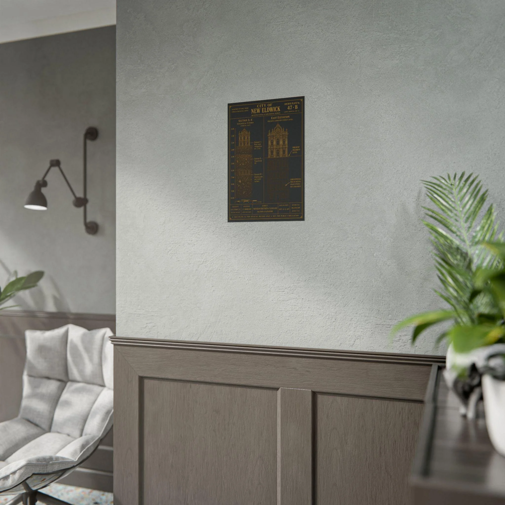
This plate was not meant to be seen.
Commissioned by the Bureau of Municipal Survey, City of New Eldwick, Survey Order No. 1887-42. Surveyed by B. H. Linden, C.E., Municipal Engineer, assisted by J. P. Morrison, Survey Draftsman. Filed under Record MS/47B/1887. Marked for official record only. Not for public circulation.
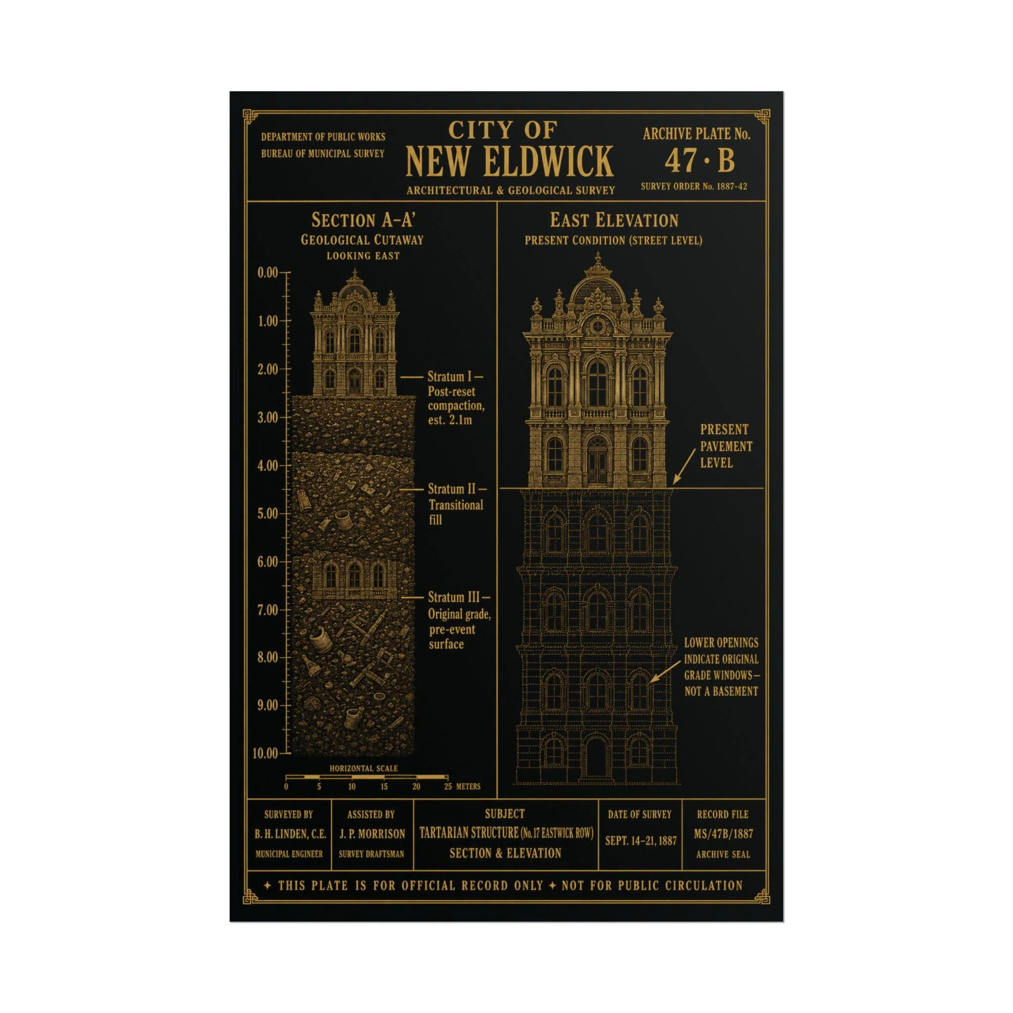
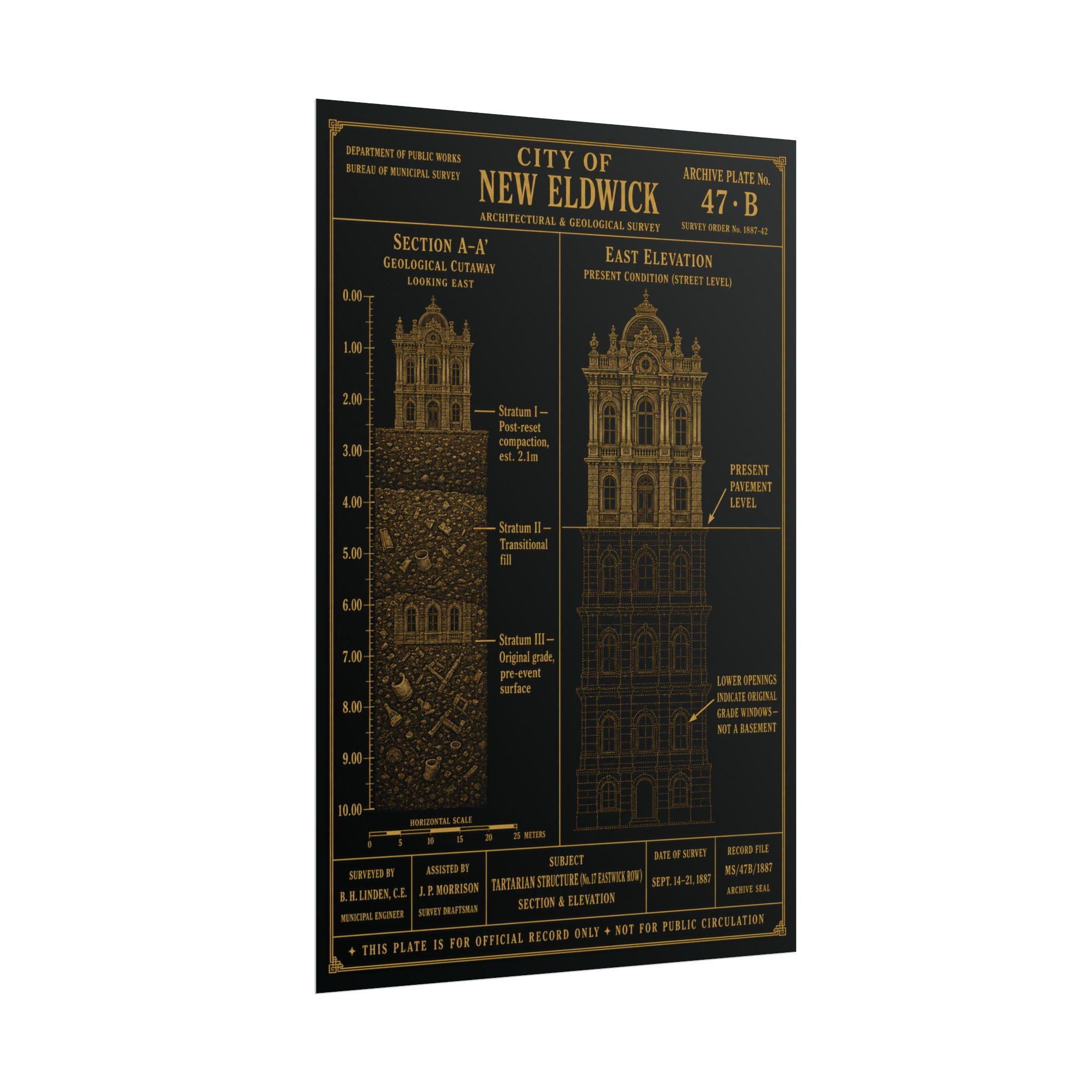
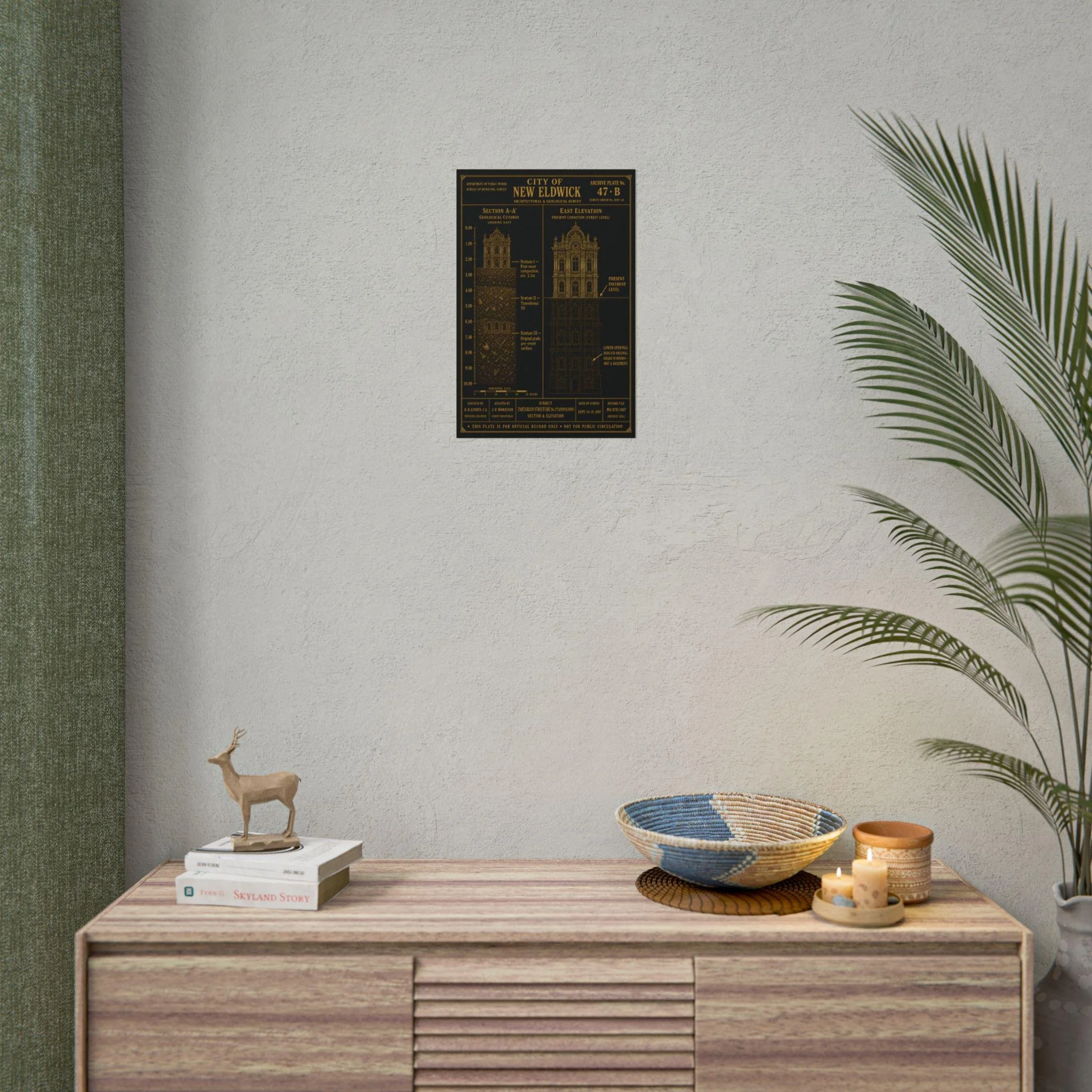
Archive Plate 47·B documents Tartarian Structure No. 17, Eastwick Row — a geological cutaway on the left, an east elevation on the right. Together they establish what the survey team recorded and what the record was never intended to confirm: that the present ground level is not the original ground level. That the building did not sink. That the earth came up around it.
Section A–A' shows three strata above the original grade — Post-reset compaction at an estimated depth of 2.1 metres, Transitional fill, and the original pre-event surface at approximately 7 metres below present pavement. The east elevation shows the same building as it stands today: grand arched windows beginning below street level, lower openings that were never designed as basement windows, a foundation that is not a foundation.The layers don't lie. The survey does not speculate. It only measures.Printed on museum-quality matte paper sourced from Japan.
Product details: • Printed on high quality matte poster paper • Sharp, clean print with vibrant color • Vintage propaganda-inspired artwork • Matte finish • Wipe clean with a cloth • Ships rolled in a protective tube
Part of the Etherfolk Hidden Histories Collection.
This plate is for official record only. Not for public circulation.
This plate was not meant to be seen.
Commissioned by the Bureau of Municipal Survey, City of New Eldwick, Survey Order No. 1887-42. Surveyed by B. H. Linden, C.E., Municipal Engineer, assisted by J. P. Morrison, Survey Draftsman. Filed under Record MS/47B/1887. Marked for official record only. Not for public circulation.
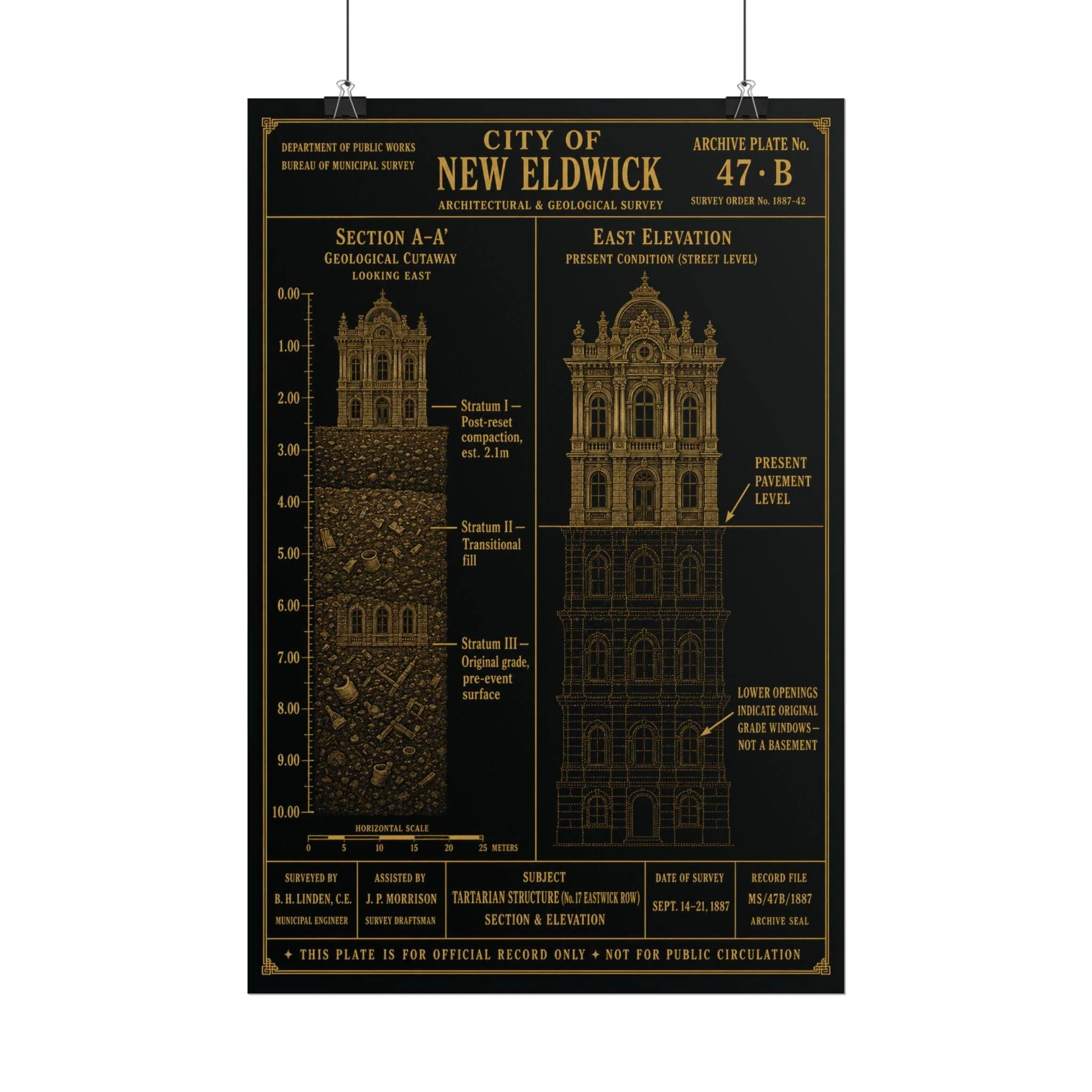
Archive Plate 47·B documents Tartarian Structure No. 17, Eastwick Row — a geological cutaway on the left, an east elevation on the right. Together they establish what the survey team recorded and what the record was never intended to confirm: that the present ground level is not the original ground level. That the building did not sink. That the earth came up around it.
Section A–A' shows three strata above the original grade — Post-reset compaction at an estimated depth of 2.1 metres, Transitional fill, and the original pre-event surface at approximately 7 metres below present pavement. The east elevation shows the same building as it stands today: grand arched windows beginning below street level, lower openings that were never designed as basement windows, a foundation that is not a foundation.The layers don't lie. The survey does not speculate. It only measures.Printed on museum-quality matte paper sourced from Japan.
Product details: • Printed on high quality matte poster paper • Sharp, clean print with vibrant color • Vintage propaganda-inspired artwork • Matte finish • Wipe clean with a cloth • Ships rolled in a protective tube
Part of the Etherfolk Hidden Histories Collection.
This plate is for official record only. Not for public circulation.