
What Was the Real Tartarian Flag?
Search for the Tartarian flag and you will find the same two images repeated across the internet, almost never with a source attached. One shows an owl. The other shows a griffin on a yellow field. They appear on flags, in forum posts, in videos — copied from one another, traced back to nothing.
So where do they actually come from? Are they inventions of the modern Tartaria revival, or do they have real provenance in the historical record?
The answer is more interesting than either side of the usual argument. Both images are real. Both appear in genuine 17th and 18th century European sources. But what they actually represent — and how much the record will tell you — requires going back to the documents themselves. This is what those documents say.
Two Flags, Not One
The first thing to understand is that the owl and the griffin are not two competing versions of the same flag. In the historical sources, they are two different emblems serving two different functions.
The distinction appears consistently across the early references: the crest of Tartary was the owl. The flag of the emperor was the griffin on a yellow field. One was a heraldic crest associated with the territory; the other was the personal standard of its ruler. Conflating them — treating "the Tartarian flag" as a single design — is the first error that the online versions tend to make.
To understand each, you have to go to where each one actually appears.
The Owl: World Geography, Paris, 1676
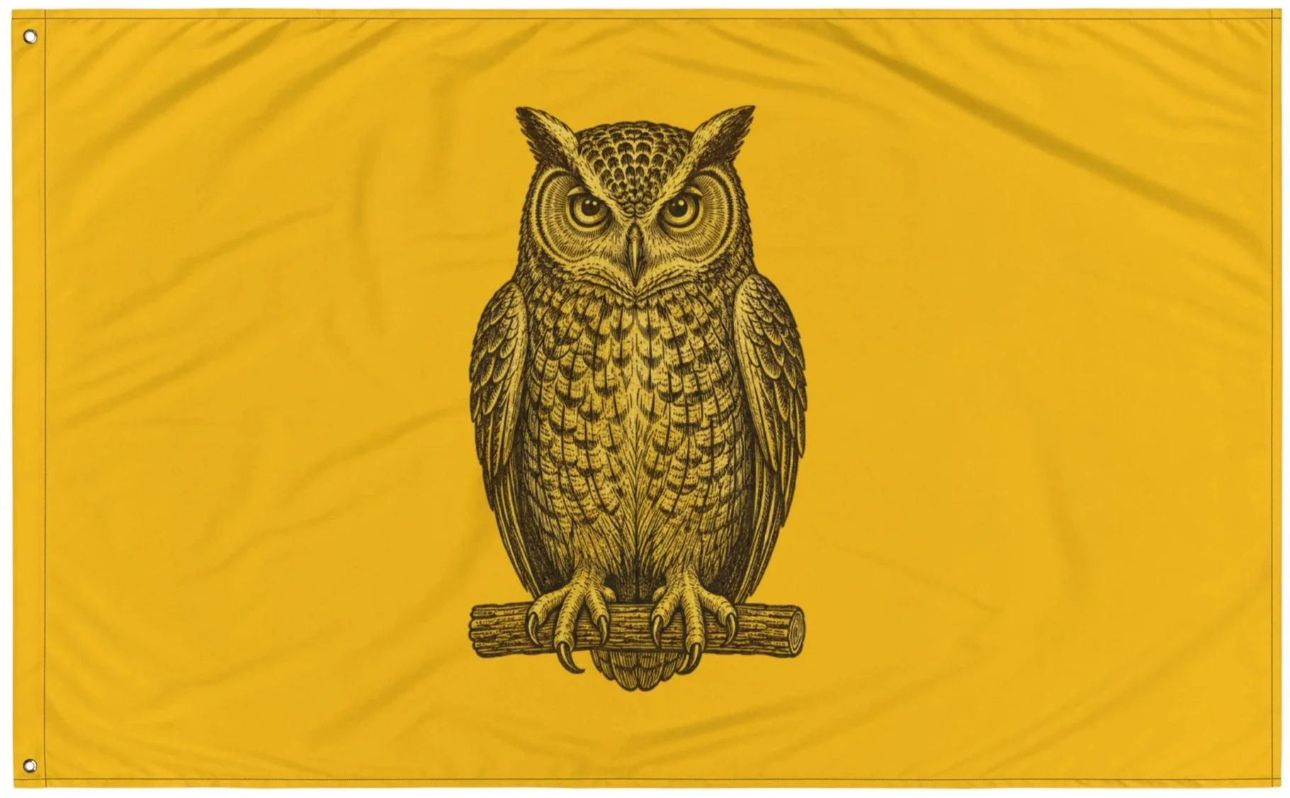
The earliest of the commonly cited sources for the owl emblem is a French geographical work published in Paris in 1676. In its article on Tartary, the text is preceded by an image of an owl on a shield.
This is significant for a few reasons. It places the owl emblem in a serious cartographic and geographic reference more than three centuries ago. It associates the owl specifically with Tartary as a territorial crest. And it sits within the established practice of assigning heraldic devices to regions on maps and in geographies — the device by which a place was known and represented.
The owl, in this source, is the crest of the territory. Not a national flag in the modern sense, but the heraldic device standing for the land called Tartary.
From the Archive
The Griffin — Or Is It a Dragon? Allard's Book of Flags, Amsterdam, 1705
The griffin has the richer paper trail, and it leads to a specific, nameable document — and to a surprise.
The most cited source is The Book of Flags (1705), compiled by the Amsterdam cartographer and publisher Carel Allard — his name also appears as Carel Fredebald Allard and, in the Russian translation of 1709, as Carlus Allard. Allard was a real and prolific figure in the Dutch golden age of cartography, and his flag books were genuine reference works, cataloguing the ensigns and standards of the world's powers.
In Allard's work, the flag attributed to the ruler of Tartary is described in striking heraldic detail. The Russian translation of 1709 renders it as: a flag of the king of Tartary, yellow, bearing a black dragon — a great serpent — with a basilisk tail, couchant, facing toward the fly of the flag.
Read that again, because it changes everything. What the modern world sells as a griffin, the period source describes as a dragon — a great serpent with a basilisk tail. The clean black griffin passant on a gold field that circulates today is a later interpretation, a tidying-up of what the 1705 source actually recorded as a serpent-tailed creature lying in wait. The looped, serpent-like tail still visible on the modern versions is the surviving trace of that original "basilisk tail." The griffin everyone knows is the dragon, smoothed over by time and retelling.
Allard's flags were also reprinted from earlier work. The yellow flag with a black-and-white owl appears in Allard's Nieuwe Hollandse Scheepsbouw (Amsterdam, 1694), and these images were reproduced for decades after.
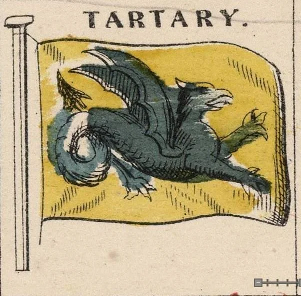
The flag of Tartary as recorded in period sources — not the griffin of modern reproductions, but a black winged dragon with a coiled, serpentine tail, exactly as Allard's 1705 description specified: "a black dragon (great serpent) with basilisk tail, couchant."
Flag of Tartary, from a 19th-century "Flags of All Nations" chart. Public domain, via Wikimedia Commons.
From the Archive
What the Record Holds
Here is what can be said with confidence, and it is more than the skeptics allow.
The owl and the dragon are genuinely attested. They appear in real, datable European sources — the 1676 Paris geography, Allard's 1694 and 1705 flag books, and their reprints. The images circulating today are not modern fabrications. They are centuries old, set down by the cartographers and geographers of their age, preserved in the documented record. Anyone who tells you the Tartarian flags were invented by the internet has not looked at the sources.
What the record gives us, then, is this: the emblems existed, they were recorded by serious men in serious works, and they were attached specifically to Tartary — the owl to the territory, the dragon to its ruler. The standard vexillological commentary tends to add that these may have been heraldic conventions rather than banners documented in active use. That is one reading. But the documents themselves do not say that. The documents simply record the emblems of Tartary, plainly, as the emblems of a place and a ruler that the same era's maps showed as one of the great powers of Asia.
What you make of the gap between the recorded emblem and the world it came from is the question the whole inquiry turns on.
When the Record Goes Quiet
The institutions that hold the maps have their own account, and it is worth knowing — not because it settles the question, but because of how it answers it.
Asked about a Tartary flag shown on a 19th-century "Flags of All Nations" chart, the keepers of the modern map record could offer no information about it, and no evidence that it belonged to any sovereign state. The flag simply sat there, unexplained, on a document that confidently named the banners of every other nation on earth.
This is the pattern the inquiry keeps running into. The emblem exists in the record. The civilization it belonged to does not — not in the official account. The flag is printed, catalogued, and then declared to belong to no one. A banner with no nation. A standard for a country that the same institutions insist was never a country at all.
You can read that absence as proof there was nothing there. Or you can read it the way those who kept looking tend to: as the precise shape an erasure leaves behind — the emblem surviving in the archive long after the thing it stood for was written out of the history. The map remembers what the textbook forgot.
The Maps Remember
It is worth recalling how thoroughly Tartary once filled the European map, because it makes the silence that followed all the louder.
For three centuries — from the 1500s well into the 1800s — Great Tartary appeared on the maps of every major European cartographer. Ortelius placed it across the whole of northern and central Asia in 1570. Blome, Sanson, Visscher, de L'Isle — the most authoritative mapmakers of their ages drew Tartary with the same confidence they drew France or China, a vast dominion stretching from the Volga to the Pacific.
And then, across the 18th and 19th centuries, it thinned and vanished. The single Great Tartary fractured into "Chinese Tartary," "Independent Tartary," "Muscovite Tartary," and then into Siberia, Turkestan, Mongolia, Manchuria — until the name was gone from the map entirely. A dominion that had filled the maps of Europe for three hundred years became, in the official telling, a vague misunderstanding, a label outsiders had used for lands they didn't know.
The flags belong to that vanished dominion. The owl that stood for the territory, the dragon that flew for its ruler — emblems of the empire the maps once showed and the record later closed.
The Answer
So what was the real Tartarian flag?
There were two emblems, serving two functions, recorded in real sources across the 17th and 18th centuries. The owl was the crest of the territory, appearing in the 1676 Paris World Geography on a shield. The dragon — the great serpent with a basilisk tail, not the griffin of later retelling — was the standard of the ruler, catalogued most famously in Carel Allard's Book of Flags in 1705.
Both are centuries old. Both are documented. Both belonged to the dominion the maps called Great Tartary before the name was quietly erased from them. The images that circulate today are real in their lineage, simplified in their rendering, and waiting — like Tartary itself — for those willing to look past the cleaned-up version and back to what the record actually set down.
The griffin is what we were handed. The dragon is what was written first.
From the Archive
Etherfolk renders the heraldry of the old world from the documented sources — the emblems, the standards, and the devices recorded across three centuries of maps and flag books. Three versions of the Tartarian standard, each drawn from a different point in the record:
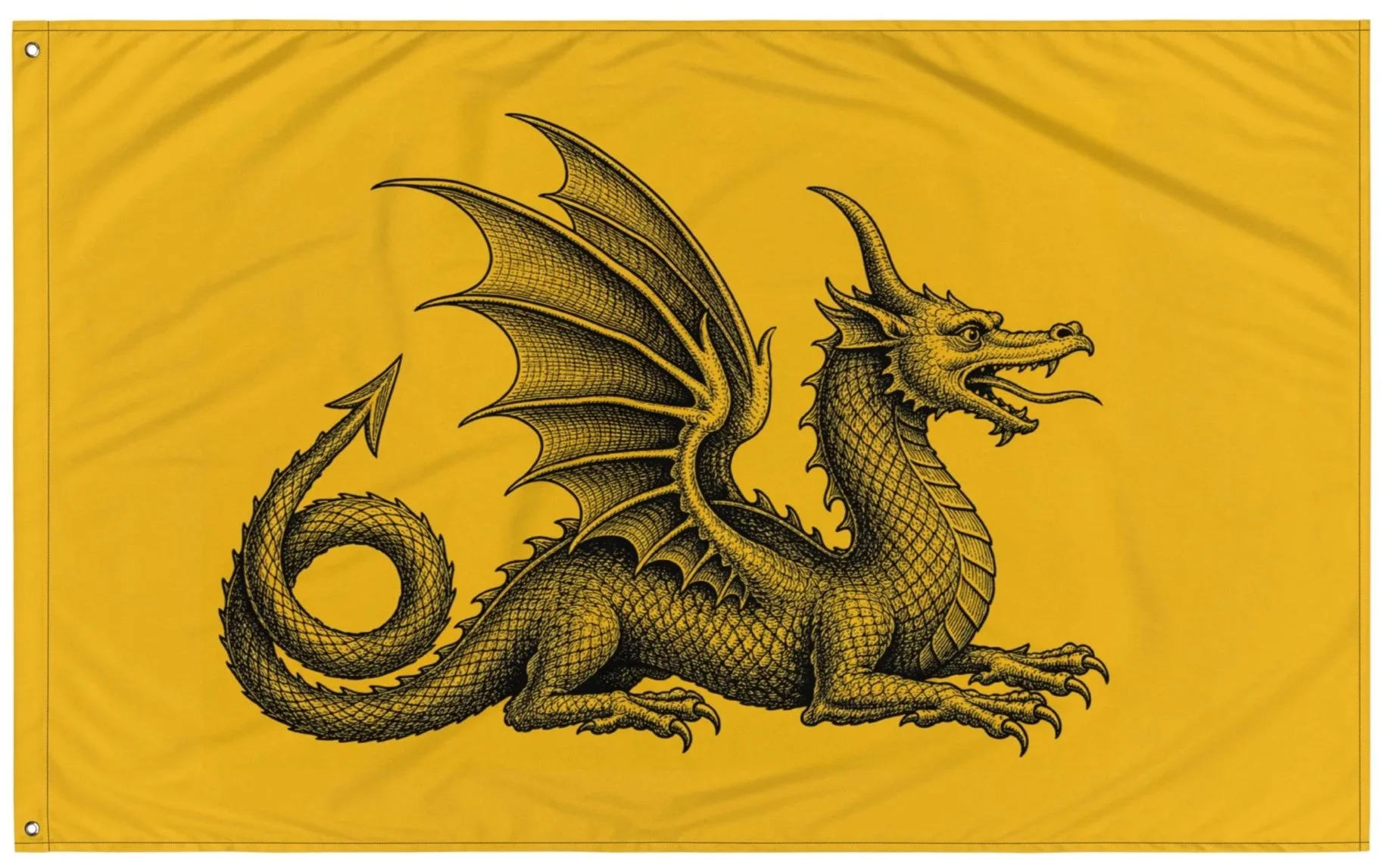
Tartarian Dragon Flag
The emperor's standard as the period sources actually described it — a black winged dragon with a coiled, serpent-like tail ending in a basilisk point, couchant and facing the fly, on a golden field. Rendered from Allard's 1705 description. The accurate one, before the serpent became a griffin.
Tartarian Owl Flag
The crest of the territory rather than the standard of its ruler — the owl recorded in the 1676 Paris World Geography, perched and forward-facing in the engraving style of the period. The older, quieter emblem of Tartary.
Tartarian Griffin Flag
The version the modern world knows — the black griffin passant on a gold field, as it circulates today. The cleaned-up heir to the older designs. For those who want the emblem as the present age remembers it.
Tartaria Collection
The architecture, symbols, and cartographic record of the dominion the maps called Great Tartary, and the modern world quietly renamed.
Etherfolk is an independent archive exploring time, sky observation, symbolism, and the structures that shape perception. Preserving inquiry beyond standard narratives.
Sources referenced: World Geography (Paris, 1676); Carel Allard, Nieuwe Hollandse Scheepsbouw (Amsterdam, 1694); Carel Allard, The Book of Flags (Amsterdam, 1705; Russian translation 1709); Flags of the World vexillological archive; Library of Congress Geography and Map Division, "Tracking Tartary on Western Maps" (2025).